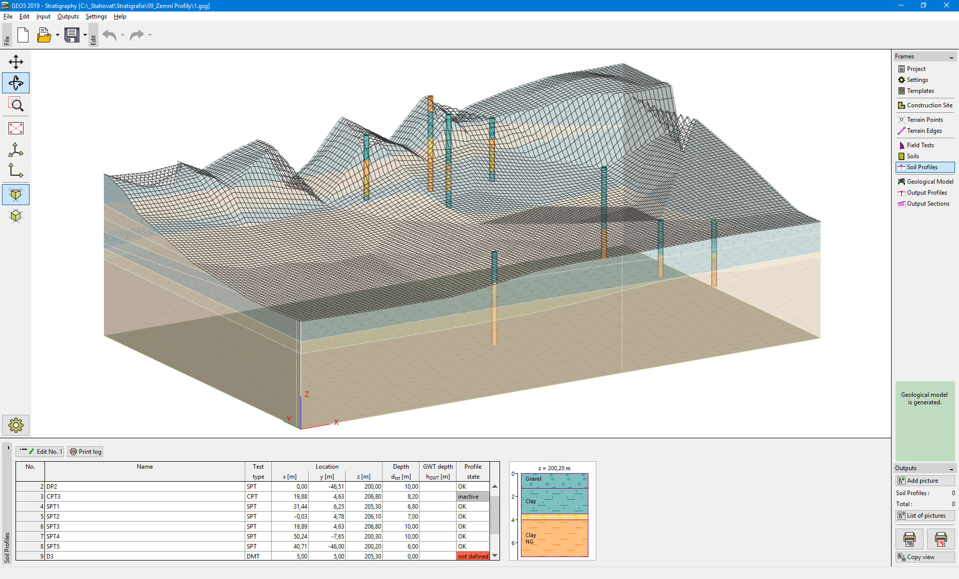
Soil Profiles
The "Soil profiles" frame contains a table with all input soil profiles. The name and coordinates of the original field test and type of the soil profile are visible in the table. Next to the table, the selected soil profile is displayed.
Soil profiles are created automatically from the field tests. The name of the test and its coordinates cannot be entered or edited - they always correspond with the original field test.
The soil profile is an interpretation of the field test into a geological profile.
Soil profiles are further used for the creation of boreholes. The geological model is created from the boreholes. Each correctly entered soil profile creates a borehole (if it is not disabled using "Profile is active for geological model generation" button).
If one or more soil profiles are selected, the button "Print log" is shown on the toolbar. Using this button, we can print soil profile together with field test as a part of geological documentation.
If the soil profile is not correctly entered, it is displayed in red in the table with a "not defined" description. In this case, the borehole is not created from the test.
If the soil profile is located out of the construction site, the soil profile is not visible, and it does not create a borehole.
Creation of soil profile depends on the type of field test:
- Creation of soil profile from borehole
- Creation of soil profile from CPT
- Creation of soil profile from DPT, SPT, PMT, DMT
Interpretation of field test into a soil profile can be carried out when modeling geological sections.
During this process, the soil profiles can be directly created or edited.
 Frame "Soil Profiles"
Visualization of drawing on the desktop can be modified in the "Drawing Settings" frame and with the help of buttons on the toolbar "Visualization".
The "Undo" button is an important program tool. It allows us to return back to the original state before any modification.