Alignment of Two Point Clouds
The "Alignment of two point clouds" function allows you to convert the coordinates of a point cloud to match the coordinates of another cloud.
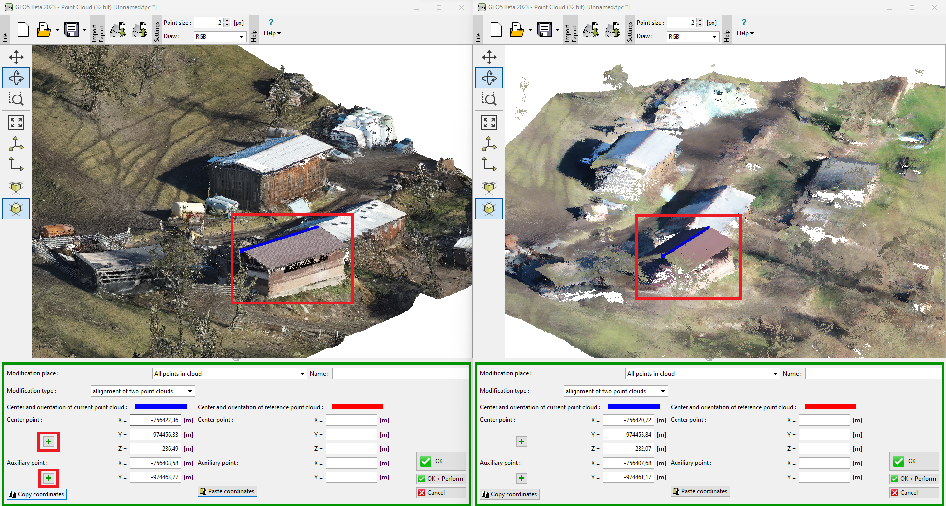
The easiest way to use it is to open the task in two separate windows side by side and then copy the coordinates from the original cloud and paste them into the current one (the one you want to align). It is also possible to open individual point clouds in separate construction stages — these stages are independent of each other.
The principle is to find a semi-line that should match in both tasks. The semi-line is defined using a midpoint and an auxiliary point.
The figure below shows two point clouds whose coordinates have been shifted relative to each other and needed to be aligned. The roof ridge of one of the buildings was chosen as the alignment semi-line. The detailed procedure is described in Engineering Manual 50: Basic Work with Point Cloud program.
 Alignment of two point clouds